Home » Satellite images reveal environmental damage caused by mining
Satellite images reveal environmental damage caused by mining
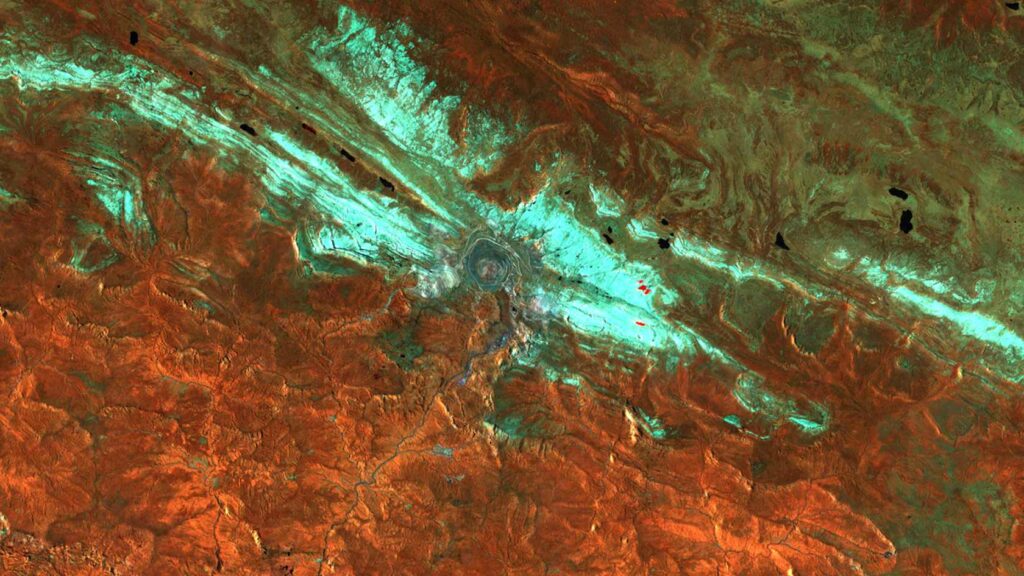
Alexander Damm-Reiser, Professor of Remote Sensing of Water Systems at UZH, uses satellite data to analyze the impact of industrial activities on ecosystems. One example is the Grasberg mine in Papua New Guinea, one of the largest and highest mines in the world. Near-infrared satellite images show the destruction of the tropical rainforest. More information can be found in the article “Wounded Rainforest” in the current issue of the UZH Magazine.
A satellite image in the near infrared range: it shows the Grasberg mine in Papua New Guinea. The crater of the mine is clearly visible in the center of the image. (Image: Modified Copernicus-Sentinel-2-Daten/Cloud Score+ /Google Earth Engine)
Spatial Sustainable Finance is a joint project of the ZHAW School of Management and Law, the ZHAW School of Life Sciences and Facility Management and the Institute of Geography at the University of Zurich. The aim is to provide companies with an objective and scientifically sound assessment of their ecological footprint, particularly in relation to biodiversity and water systems. The aim is to enable investors to make informed decisions about sustainable investments. The project is funded by BRIDGE Discovery. As part of the 1st Rapid Action Call in the DIZH Innovation Program, the data-based model BioVaR was developed, which translates local, nature-related risks into financial impacts.